WEDNESDAY FEB 20 to MONDAY FEB 25
THE WILD SOUTH
I will preface this by apologizing for the length of the post … it covers 5 days in Patagonia

Well here we are in “The Wild South”…. Now I will preface this by saying I know nothing about Patagonia … when I hear Patagonia I think of a ski jacket and that is where my knowledge begins and ends. But now that we are here “the Wild South” is actually starting to make sense….it is similar to the Wild West… when the pioneers were exploring uninhabited frontier ….

In fact to get to Patagonia from Chile you must either take a boat or go through Argentina. Patagonia is a remote location with almost no roads, no airports, fast changing weather….very hard to get to without a boat or hiking.
Our Patagonia journey consists of 3 stops over 5 days so this post will include stops 15 to 17 (Day 25 to 29)

PUERTO CHACABUCO DAY 25 Stop 15.
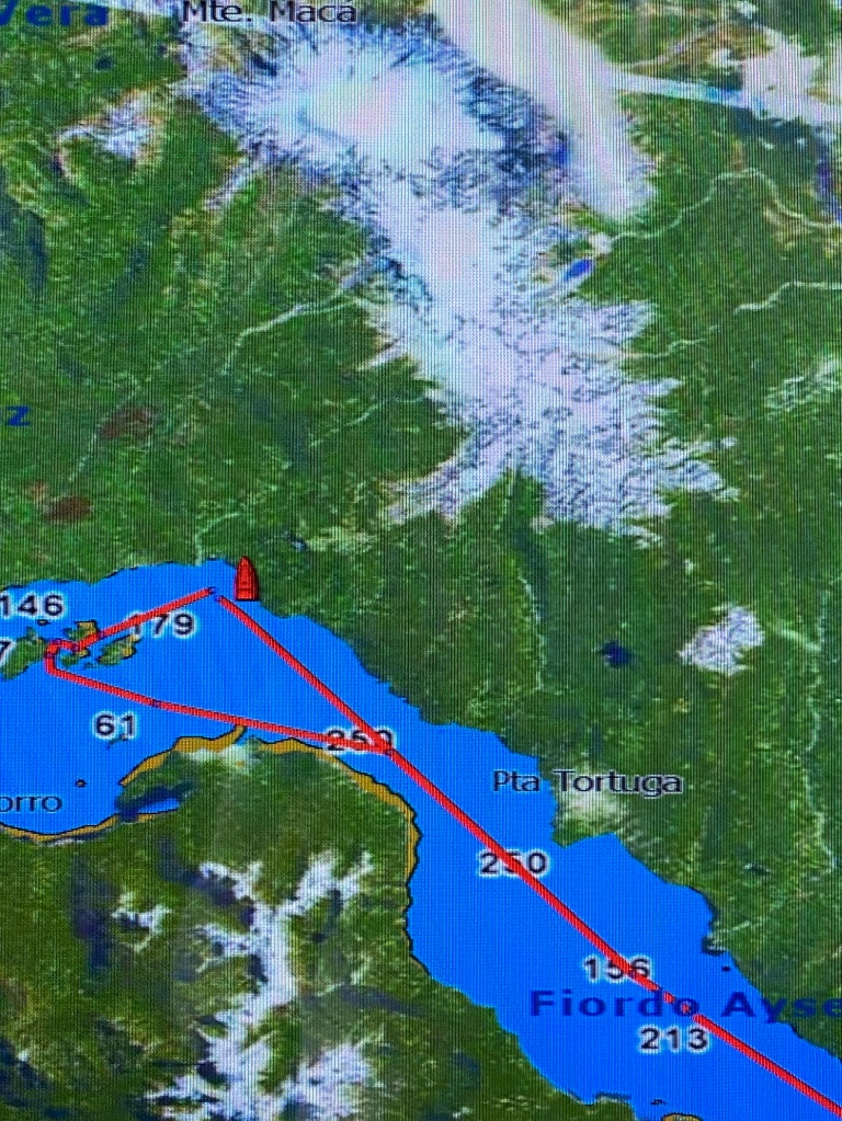
LAGUNA SAN RAPHAEL DAY 26 Stop 16
CRUISING THE CHILEAN FJORDS DAY 27/28
PUNTA ARENAS DAY 29 Stop 17

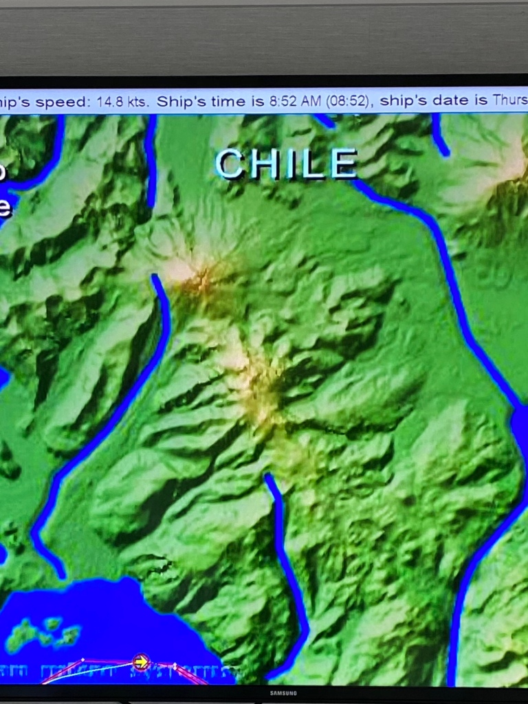
Patagonia is a region located in the southern end of South America, territory shared by Argentina and Chile…. it is considered “some of the most dramatic landscape in the world.” The region includes the southern section of the Andes mountains, southwest to the Pacific Ocean.
Patagonia covers 400,000 square miles and is populated by 2 million people….(2 people for every 5 square miles) ….the area spans the southern parts of Chile and Argentina, divided by the Andes.
The name Patagonia comes from the word Patagon and means “big foot”….. not the white hairy creature we’ve all heard of running around Canada. The name came from Magellan who discovered the area in 1520. It was used to describe the native people who were thought to be giants. It turns out they were actually Tehuelches, an indigenous tribe to Patagonia, with an average height of 5’9”compared to the Spaniards 5’1”…what a bunch of shrimps….but to them Patagons were giants. The Tehuelches are still in Patagonia today and reside primarily on the Argentinian side.
Southern Chile is rich in forests and grazing lands, volcanos and lakes and the coast is a maze of fjords
…Fjord… cool word …but I didn’t know what it was….I had it confused with a gnome…the little people you see in the forest in storybooks who live under mushrooms….
A Fjord is actually a long deep narrow body of water…reaching far inland….it is created when a glacier retreats forming a narrow steep crevice connected to the sea. …
Waterways, inlets, canals, twisting peninsulas. islands and archipelagos are also all part of the region. Archipelago is another word that I did not really know what it meant…sounds like a musical instrument related to a cello … it is actually a collection of islands
Southern Chile has LOTS of rain and heavy precipitation (335”/yr 10x more then the US) producing dense forests, laurels, magnolias, beautiful scenery … distinctly different than the Argentinian areas of Patagonia that are much more arid and dry.
… and much of the Chilean flora is different than Argentina because of the climate differences…. the Andes provide the dividing line in Patagonia, not only for two countries, but also two distinct weather systems
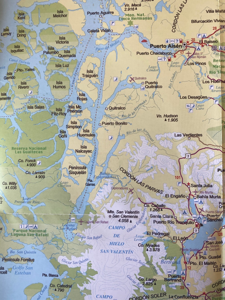
PUERTO CHACABUCO Stop 15
Puerto Chacabuco is the main port in Chile for the Patagonia region and named for a naval ship that explored the area in the late 1800’s.

It is the port of entry to the Asyen Fjord. Asyen is the name of the Patagonian region of Chile…. sorry so many different names… it took awhile to figure it all out……

This was our first stop
…..the population in Chacabuco is 800 so the port is obviously tiny….from here we took a smaller boat to explore the fjord

….the area is surrounded by breathtaking scenery and natural hot springs fed from a volcano.


The water is rich in minerals and considered highly therapeutic…. and yes I went in ..it didn’t do much for me… I must admit I was hoping there would be a shop … so much for being a nature enthusiast….then again maybe I could buy some land😊
Next stop “The Lagoon”
LAGUNA SAN RAFEAL Stop16

Laguna San Rafael is a body of water discovered in 1575. It is named after a catholic saint, Laguna San Rafael (St Rafael’s Lagoon). The lagoon is (16k) 10 miles by (11k)7 miles and 70’ deep
Laguna San Rafael became a national Park in 1959… covering nearly 4 million acres. It is the largest park in the Aysen region.
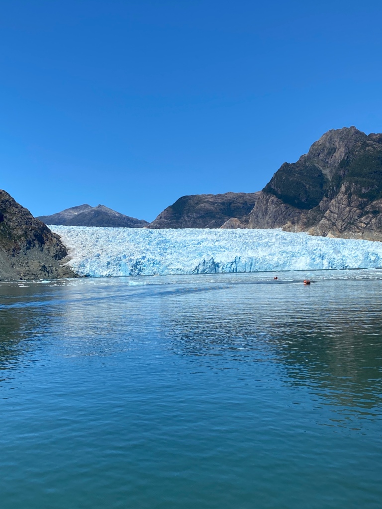
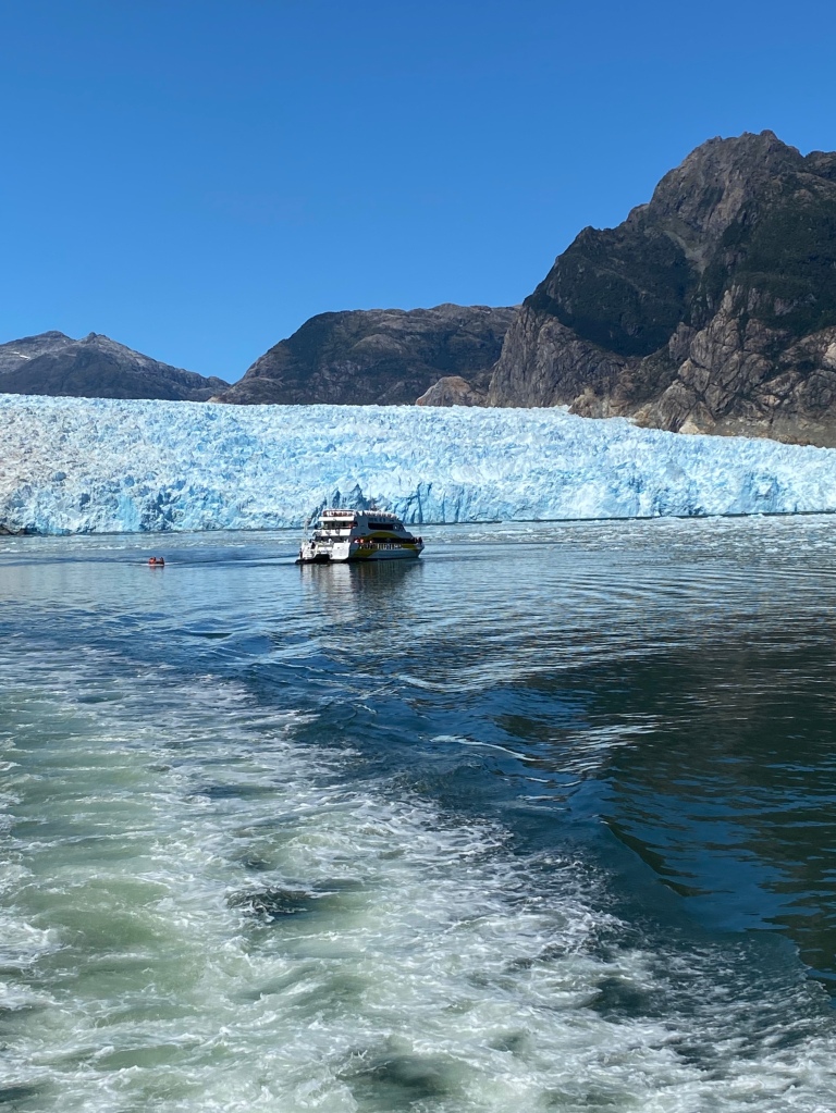
The park was named after the lagoon and covers a large expanse of water, mountains, lakes and glaciers formed by the retreat of the San Rafael glacier.
The park is best known today for the northern Patagonia ice fields.
In 1979 the park became a UNESCO world Heritage Site and the Northern Icefields became part of the UNESCO World Biosphere Reserve… big word …simply means the ice fields were designated as a natural habitat to be protected.
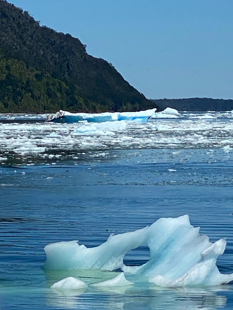
The San Rafael Glacier is the closest glacier to the equator. The glacier is 68’ long and 3470’ thick. The glacier is 695 deep at the base and feeds numerous rivers and lakes … the water at the foot of the glacier is 700’ deep.


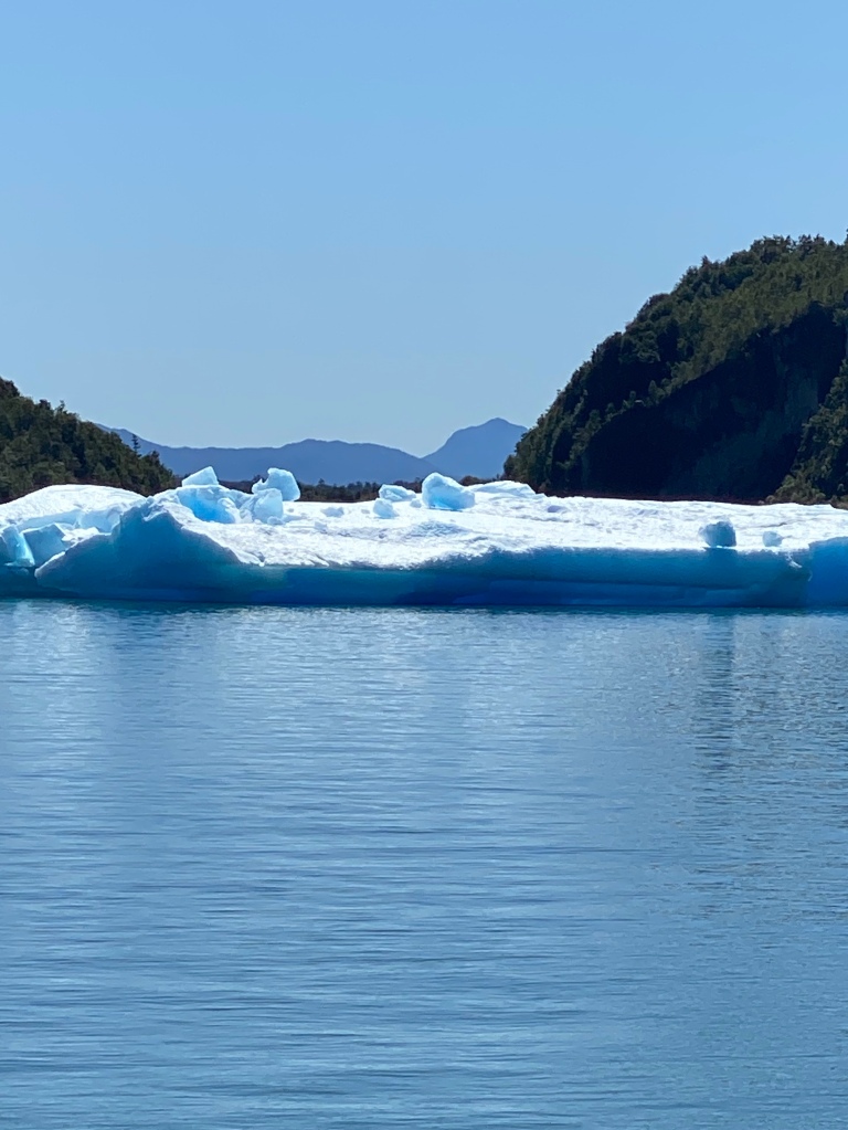
Floating icebergs from the glacier.

The ice is blue…..it is blue because there are no air bubbles in the ice…..years of snowfalls have compacted the snow/ice and without the air bubbles it reflects blue.
The tallest peak in the southern Andes is Mount San Valentin… extends from the glacier 13,300 ft. The ice fields extend over this mountain and surrounding hills, creating 19 other glaciers
The park has extensive wildlife, water/land birds… and sea life ….
Elephant seals, weighing over 3 tons…large Sea lions that eat nearly 8 % of there body weight at one time … (that would be a 180lb man eating a 14lb Hamburger) OMG! There are also black dolphins and Marine otters that live in crevices along the shoreline.
Unique Seabirds, ducks and Cormorants, also ininhabit the area. These sea creatures were depicted in drawings by early civilizations.
CRUSING THE CHILEAN FjORDS
The park has incredible natural beauty…snow capped mountains …icebergs floating in the water, seabirds, and sea animals.
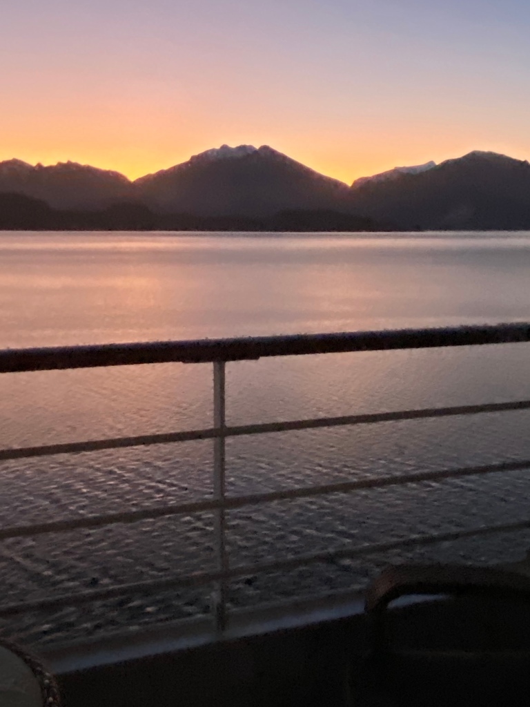
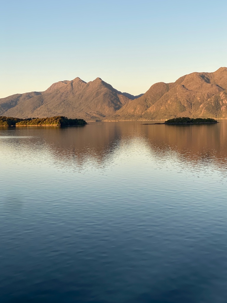


8:00 PM cruising the Fjord

Since we are so far south the sun sets late.. around 9:30

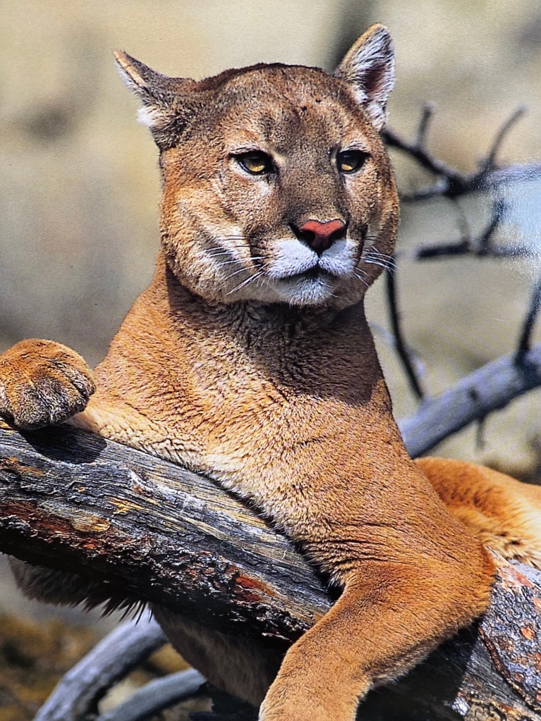
Land animals that inhabit Patagonia include unique species to the area…distinctive cougar, llama, fox and small deer in the forest region are only found in this area….and many species of birds including Magellanic penguins (another story for another day) and Orca whales.
Temperatures in the area range from 40F to 55F … but strong sun can make it feel much warmer… with 325 inches of rainfall it rains almost every day.
So on our way to our last stop in the Chilean side of Patagonia …. crossing through the Magellan Straits

Strait…(another word I didn’t know … amazing I passed geography) …..a strait is a narrow passage of water connecting two seas… in this case the Atlantic and the Pacific….now it all makes sense


PUNTA ARENAS Stop 17
LAST STOP IN THE CHILEAN SIDE OF PATAGONIA
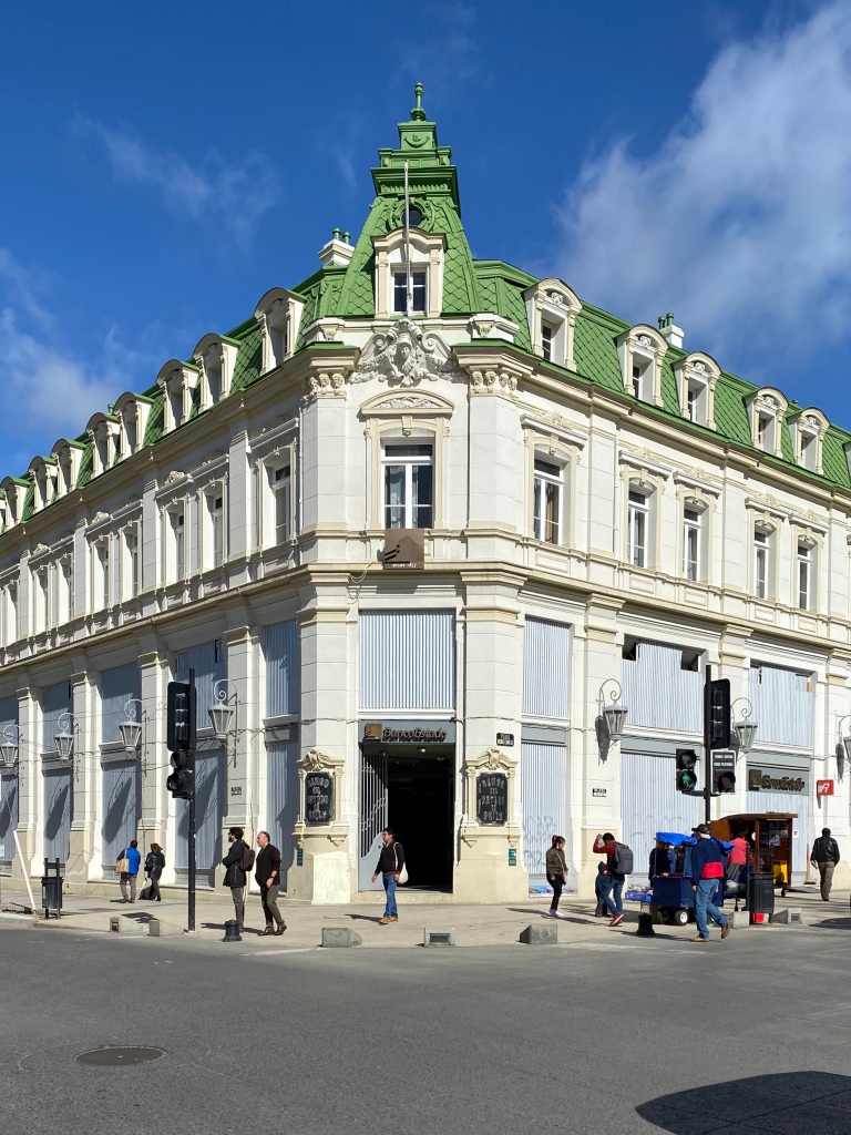
And here we are in Punta Arenas …. “The Southern most City on Earth”


Punta Arenas is part of one of the most historic trade routes in the world and the cities economy rises and falls with trade.

The Spaniards established themselves here in the 1500’s to control the straits, preventing piracy from the English … the area became part of Chile in the mid 1800’s.

Today the port is a main hub for Antartica and this year is celebrating it’s 500’th birthday.
Puerto Arenas is very different then the other areas of Patagonia…it is a city …155,000. The population is a mix of cultures from English sheep herders, Portuguese sailors and a blend of other Europeans.

The roots of the city originate from Spain and Croatia who came in the mid 1800’s ….about 50% of the population are descendants from the Croats.
The climate in this location is very harsh in the winter averaging around 32 degrees with regular snowfalls. Spring and summer are in the 50’s ….though it can feel much colder due to the high winds off the straits.
Plaza de Armas is city center, featuring a monument of Ferdinand Magellan overlooking the Magellan Straits.

a statue in his honor in the center of city square

Local food is lamb or fish (salmon, eel and hake combine with shrimp and king crab.) and a tradition in the region is to drink wine or Pisco Sour in a leather boot.

Lamb is everywhere ..eat it, sheer it,sell it (wool yarn and clothing )…sheep for many is their livelihood

So a few observations while walking the city….. It is charming ….people are polite, the city is clean but it looks as if Santiago ….1600 Miles away… has had its influence….lots of graffiti

I did come across some pay phones…This one is actually 2 sided.

And trash is put in Wire baskets on stands in front of each house for pickup …. interesting idea… it does seem a little cleaner then seeing garbage spilling all over the road
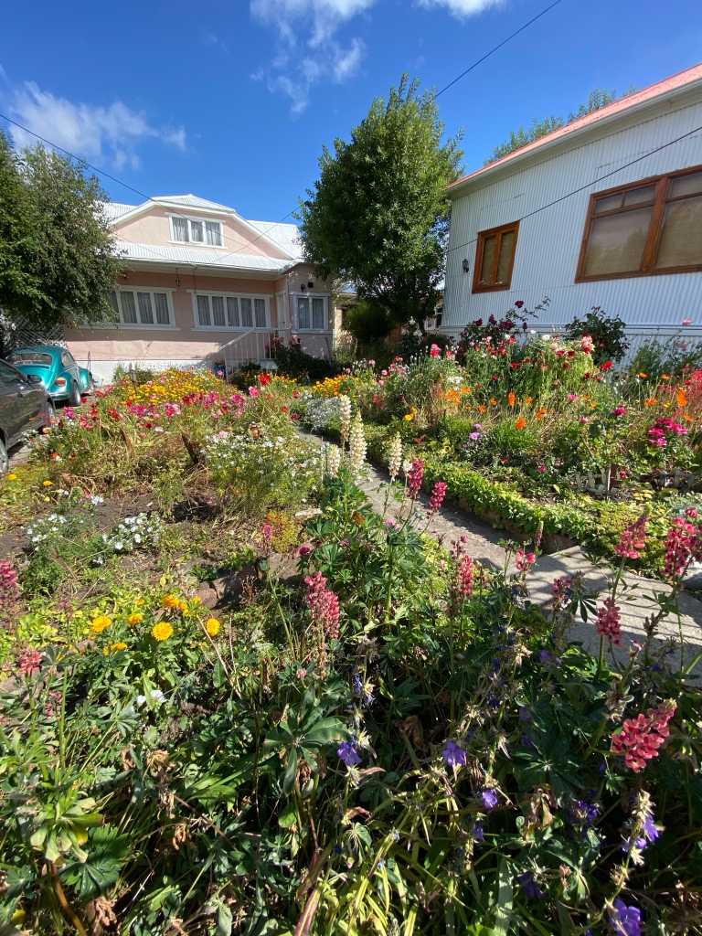
The City is charming… a blend of Europe and South America…. plenty of green space and parks, surrounded by a “wild sea” because of the strong winds, and a most intensely blue sky ….with a smell of pure “clean air”…. I didn’t know what to expect at the “southern most city on earth”….I never even knew there was one.
So after 11 days in Chile …it is an amazing country ….with 3600 miles of coastline, longer then the United States, with such diverse topography and weather systems…

North Chile, primarily a desert with mineral wealth from copper. The central area, having most of the countries population and agricultural resources, and the south….Pantagonia ……a true paradise for nature lovers and a playground for scientists… one of the few remaining untouched areas of the world ……
Chile is a fascinating country to continue to watch…. as it try’s to lay claim to 480, 000 sq mi of Antarctica….an oil rich area. (claims are currently suspended under the Antarctic Treaty) It is a strong economy, proud people, currently dealing with social unrest….. it will be interesting to watch it unfold and a place to come back to in the future….
Now …the only way out of Chile’s “southern most city on earth” is by boat… so back to the ship
…..Next stop Argentina

Thank you so much for sharing your experiences with me.
LikeLike
Happy to… glad you are enjoying… I figured you would like Patagonia … Helene may like to read about it to. I am
Happy to add her if you want.
LikeLike
Love Chile! So glad you enjoyed it. We have some of the same photos in Puntas Arenas! Can’t wait to see what is in Argentina down there!
LikeLike
I can’t wait as well😊
LikeLike
Chile has been an amazing revelation Going from barren Deserts 🌵 To lush forests to Glaciers and finally the seeming end of the World in Terra Del Fuego. It has been enjoyable
LikeLike
Did you take that cougar picture ? It’s beautiful! Argentina is supposed to be the country with most Europeans like cities in South America. will
Be curious to see your pictures. And the pictures here are beautiful!!
LikeLike
Just love reading about these adventures💕💕
LikeLike
Taking it all in
LikeLike
Wonderful post on Patagoni – before reading it, I didn’t know too much about it other than it was in the southern part of Chile. Love the photos of the glaciers and Punta Arenas. Really impressed with how much research you are doing on each of your stops – I’m learning a lot!
LikeLike
You’re doing an amazing job teaching all of us! I love being on this adventure with you. ❤️
LikeLike
Thanks Jenn…. I find it all so interesting … I had no idea how stupid I am😂
LikeLike